Posts

Jumbo Rocks - Joshua Tree National Park

Image
  Check out our “Vlog” video from Jumbo Rocks. Special Thanks to The Perks , a small band out of Southern California, for the soundtrack, as well as Lowepro, who generously sent us their new Rover Pro 45L AW camera bag to use! Jumbo Rocks is aptly named, and is the biggest campground in Joshua Tree National Park . If you’re looking for a campground full of great sites, easy access to trails, and big huge boulders to climb when you step out of your tent, this is the place to be. Spot Jumbo Rocks? It may be a little difficult – Joshua Tree encompasses almost 800,000 acres, or over 1200 square miles. However, navigating the park is relatively easy. Most will enter from the north, at either the town of Joshua Tree or Twentynine Palms. For those traveling from Arizona or other areas of southeastern California, the best entrance is from the south, off I-10 near Chiraco Summit. Arizonians – don’t exit the 10 at Desert Center, unless you’d like a long, boring detour around the park to th...
Picacho State Recreation Area

Image
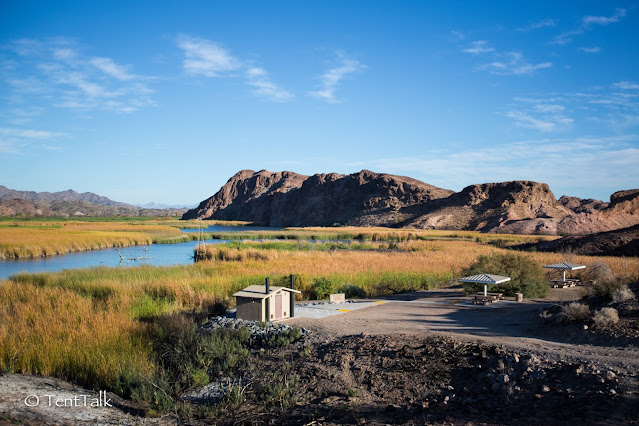
Picacho State Recreation Area, or Picacho SRA, is a beautiful estuary that protects 8 miles of the California side of the Colorado River. The park has a rich history of mining and the old town of Picacho, but now is a haven for birds and birdwatchers, boaters and anglers, and – of course – campers. Picacho SRA might be most notable for its sheer remoteness. The quickest and most accessible route is from Interstate 8 in Yuma (from the east) or Winterhaven (from the west). Although only about 24 miles north of I-8, the trip can easily take over an hour, depending on how well your car handles the 18 miles of dirt road. The road is well-maintained and often graded, but can be rendered impassable during monsoon season from flooding. 2WD and low clearance vehicles should have no problems, and trailers and RV’s work as well when the road is in good condition. California State Parks reminds all visitors to travel prepared through the desert, as there can sometimes be a lengthy period of time b...

Kayenta Campground – Dead Horse Point State Park

Image
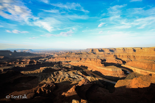
  Dead Horse State Park sits at the end of Utah 313, occupying a slim peninsula that ends in Dead Horse Point, a spectacular viewpoint of the Colorado RIver as it meanders towards Canyonlands National Park. Here is a great little video interview about the park from the Colorado River Re-Storied team, featuring ranger Megan Blackwelder. Although Dead Horse Point is considered a “Moab-area” park, it is actually a 40 minute (30 mile) drive from Moab to the parks entrance. Taking US 191 north out of Moab will take you to the junction with Utah 313, which then climbs back south onto the plateau. After a few miles, you will approach an intersection, where the 313 makes a left and continues to Dead Horse Point (if you stay straight, the road will take you into Canyonlands National Park). There are a handful of Bureau of Land Management (BLM) sites along the 313 that you can opt to stay at if Dead Horse Point is full, including Cowboy and Horsethief , as well as the group site Lone Mesa....

Havasupai

Image
Many people will tell you Havasupai is the most beautiful place in Arizona, and I'd be hard pressed to disagree. Also known as the Grand Canyon's Garden of Eden, the blue-green waters of Havasu Creek flow from the red rocks of the canyon down to the Colorado River, creating a spectacular canyon full of life and awesome waterfalls. The Havasupai (people of the blue-green waters) still make the canyon and the village of Supai their home, and only let a certain number of people enter per day (day hiking is not permitted, nor practical). Posted above is the "Vlog" style video from our recent three day trip to the campground at Havasu Falls. If you're ready to go, make your reservations here ! The Havasupai Tribe have recently updated their website, and are currently only accepting reservations over the phone due to overwhelming demand. This post will refer to Havasupai as a whole place , encompassing the Village of Supai, the Havasuapi People, and Havasu Cre...