Jumbo Rocks - Joshua Tree National Park
Jumbo Rocks is aptly named, and is the biggest campground in Joshua Tree National Park. If you’re looking for a campground full of great sites, easy access to trails, and big huge boulders to climb when you step out of your tent, this is the place to be.

Spot Jumbo Rocks? It may be a little difficult – Joshua Tree encompasses almost 800,000 acres, or over 1200 square miles. However, navigating the park is relatively easy. Most will enter from the north, at either the town of Joshua Tree or Twentynine Palms. For those traveling from Arizona or other areas of southeastern California, the best entrance is from the south, off I-10 near Chiraco Summit. Arizonians – don’t exit the 10 at Desert Center, unless you’d like a long, boring detour around the park to the Twentynine Palms Entrance. Likewise, for those coming from LA, the quickest way to Jumbo Rocks is to take the 62 Freeway north to Yucca Valley and the Joshua Tree entrance.

Joshua Tree is also unique in that there are two big campgrounds that are located in secluded, dead-end areas right inside the northern boundary (Blackrock & Indian Cove), while the northeast area of the park is congressionally protected wilderness. There are basically 3 paved roads, and almost all of the attractions are centrally located in the northwest area of the park. The California Riding & Hiking Trail winds across the park, while there are a handful of popular off-road opportunities as well.

Jumbo Rocks might not be centrally located, but it’s pretty close. Skull Rock Trail departs right from the campground (across from the amphitheater and site 93), and the hike we did, the Lucky Boy Vista-Quen Mine Loop Trail (near the bold B on the map north of Jumbo Rocks), was just a short drive away. Ryan Mt. Trail and Cap Rock are a short 10 minute drive west, while Arch Rock and White Tank are about the same distance east.
The proximity to other campgrounds is important, since all sites at Jumbo Rocks are first-come, first-serve the entire year (the only reservations accepted in Joshua Tree are for Black Rock and Indian Cove for the peak months of October through May – to reserve these campgrounds visit Recreation.gov). Jumbo Rocks is the biggest and one of the most popular campgrounds in Joshua Tree, so if you’re arriving during the peak months of May – October, plan accordingly. Even though we visited over the week of Christmas, there were a decent amount of people both in the campground and the park. It will get cold in the winter, for us it got to a low of 41 degrees at night, while barely creeping over a perfect 65 during the day. In the summer, it will be hot. Jumbo Rocks sits at 4,400 ft., but it’s still a desert!
 |


Most of the sites in this campground are incorporated into the rocks, with some even on the rock formations themselves. Most have a fair degree of privacy, although some are crammed because of where they’re located. The campground is divided into a handful of loops, while the main road has campsites on it as well. Obviously, the further into the campground you go the less traffic there is, but beware that during peak season there will be over 100 campers passing the first few sites.


The map is very helpful, but it doesn’t tell the whole story. Sites 4-9 are walk-ins, so although they look like they’re smashed right up against the road, they may actually be quite appealing for those who are up for walking their gear a little bit further into the rocks (good strategy for shade in the warmer months, but in the winter it will get pretty cold!) Loop 17-24 backs up to a more gradual slope of rocks, and might be a good place for families with younger children who want to explore the rocks but can’t tackle the bigger formations. Loop 25-41 is decent, but it elevates into a more desert-like area, with no rock formations right in the sites, which may be a deal breaker for some (like us) who love the rocks. Same goes for 42-64 and 72-76 (the loops to the bottom of the campground map are more desert, while the main road and top loops are in the rocks).


We stayed at site #77 at the far end of the campground, a large yet private site that backed up right to the giant boulders. Our favorite sites were 10 & 11 for a group, 33, 41, 77-81, 87, 95, 101, and 120. The sites to stay away from are 65-67, if only because of their proximity to the bathroom.
If you want to get a better feel for what the rocks are really like, check out our Vlog video posted above, or check out the link to the Skull Rock Trail. The rock surroundings just have a special draw – I’m not exaggerating when I say you can come to Jumbo Rocks and never leave the campground. We highly recommend coming out and enjoying this campground.

Of course, our trip wouldn’t be complete without a hike. We chose the Lucky Boy Vista-Quen Mine Loop Trail because of the proximity to Jumbo Rocks, and we also were looking for a casual hike that wasn’t too treacherous. Queen Mine actually ended up being pretty cool – well worth the hike and the spotty trails, and you can actually enter the mine at one point if you’re so inclined.
This is another confusing map, and the same one you’ll get if you visit a ranger station (click here for the entire, un-cropped map). The Desert Queen Mine Road is a dirt road that branches off from the main road (Jumbo Rocks is cut off in the map, but is directly below Face Rock, a short 5 minute drive) that will end up at a parking lot at the B symbol on the map, where the Backcountry Board is. From there, there are three trails from the parking lot. Choose the one that heads to Desert Queen Mine, which may be hard to figure out since none of them are marked (the trail you want heads almost due east, while the Pine City Trail heads north).

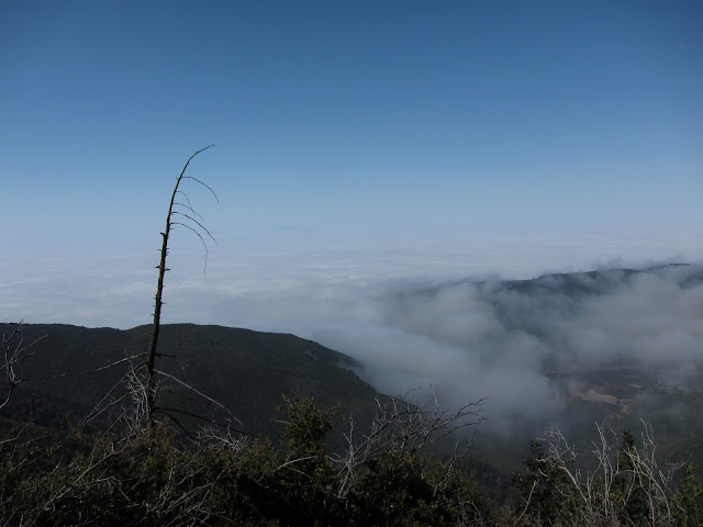
Continue to the end of the trail to see a sweeping view of the mine and the valley (see in the pictures below). However, to actually get to the mine, you need to look for the remnants of a small, well-hidden stone house to the right of the trail, before you get to the overlook. The trail down to the mine begins behind that house, which will take you down into the valley and then the trail up the side of the hill to the mines openings (this trail isn’t officially marked on the map, but it is decently maintained and the only way to get down the hill).

Once you’re in the valley, it’ll be quite clear where the pathway is to get up the side of the hill. The NPS has blockaded most of the mine entrances, but the main one near the top of the hill is actually still open – if you’re skinny enough! We were actually quite startled when we were checking out the entrance and then heard voices emanating from the mine’s depths, and it wasn’t until a young couple emerged that we figured it out what it was.

The hike is maybe 2 miles roundtrip if you stop at the mine like we did, but it’s beautiful, and checking out the mine is pretty cool. You can continue from the mine back to the loop that continues to the Split Rock Loop Trail. Again, even though there are many Carins that help guide you, the trails are not heavily travelled, and it may become easy to get disoriented. We lost the trail when coming back up a wash that had just flooded. Even though the only thing we had to do to get back on route was climb a small hill, it can still be disorienting.


Think we missed something? Have an additional question? Want to tell us a really sweet hiking spot that you discovered on your last trip to Jumbo Rocks? Leave us a comment! We’d love to hear from you!

Comments
Post a Comment