Picacho State Recreation Area
Picacho State Recreation Area, or Picacho SRA, is a beautiful estuary that protects 8 miles of the California side of the Colorado River. The park has a rich history of mining and the old town of Picacho, but now is a haven for birds and birdwatchers, boaters and anglers, and – of course – campers.
Picacho SRA might be most notable for its sheer remoteness. The quickest and most accessible route is from Interstate 8 in Yuma (from the east) or Winterhaven (from the west). Although only about 24 miles north of I-8, the trip can easily take over an hour, depending on how well your car handles the 18 miles of dirt road. The road is well-maintained and often graded, but can be rendered impassable during monsoon season from flooding. 2WD and low clearance vehicles should have no problems, and trailers and RV’s work as well when the road is in good condition. California State Parks reminds all visitors to travel prepared through the desert, as there can sometimes be a lengthy period of time before someone passes you if you become stuck (and there is absolutely no cell coverage anywhere inside the park, or within about a 15-mile radius). Keep water, some snacks, and a shovel in your car at all times, and some warm clothes are not a bad idea during the winter months. Remember, the nearest hospital is in Yuma, a long, slow drive back. Stay with your vehicle, it’s much easier to spot from the air than a wandering person.
If you’re coming east from Arizona, take the Giss Pkwy exit from I-8, pass under the freeway, and then make a quick right onto S. Gila St. Make another right on 1st St., which will take you back under I-8 before crossing the old railroad bridge into California and the Quecahn Indian Reservation. Stay on that street, which is now Quechan Dr., until you reach the T-intersection with Picacho Rd, where you’ll make another right. Stay on Picacho for a couple miles until you pass over the All-Ameircan Canal, where you’ll make a left to head to the park and the pavement will end (the intersection is marked, but can be disorienting at night).
If you’re coming west from California, exit at Winterhaven Dr., and make a left. You will quickly approach the intersection with Picacho Dr. Make a right, and stay on that road until the above-mentioned left onto the dirt road. If you’ve never been to the Yuma area before, don’t be disoriented by the odd border lines. I-8 will parallel the Mexican border until the intersection with CA-186, where it then begins to parallel the Colorado River and Arizona (you can actually travel another 25 miles south through Arizona from Yuma to the Mexican border at San Luis). The official directions from the park can be seen here.

Surprisingly, Picacho is actually known better for its wildlife than for its camping. The park sits on an important stretch of the Pacific Flyway, one of the main migratory paths for birds flying to the warmer temperatures of Central and South America for the winter. Fishing is a big draw, and is allowed 24hrs/day for licensed CA fishermen, or licensed AZ fishers with a Colorado River stamp. Bald eagles are routinely spotted here, as well as other birds such as quail, herons, woodpeckers, geese, and many others. Bighorn sheep are known to appear, as are mule deer and antelope. Wild burros are present as well; we actually saw one wandering through the campground at night when we arrived. Beware – if you visit during the active mosquito season (March through October), know that samples of West Nile Virus have been reported within the greater lower Colorado River, between Blythe and Yuma. Bring plenty of repellant and be aware of your surroundings.
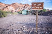
I highly recommend you make the trip to Picacho with a 4WD car, as a huge element of recreation in the park is centered around exploring in your vehicle. Although it is explicitly outlawed to use off-road vehicles such as ATV’s or blaze your own path through the desert, the extensive miles of (dirt) roads are beautiful in their own right. All of the roads we travelled on were in good shape and are 2WD passable, but I’m guessing it’s easier to justify the expensive tow to your insurance company if you’re following the 4WD regulations throughout the park. An exception is Railroad Canyon, which was easily passable in my 2WD car even though non-4WD vehicles are not officially recommended (for reference, I drive a Toyota Rav4 with off-road tires). Otherwise, roads north of Taylor Lake are off limits. However, the sign at the Taylor Lake Overlook stipulates that 2WD Vehicles are prohibited, while the official park map only says 2WD is not recommended. If I had to bet, I would say that most 2WD would manage the roads north of Taylor Lake, as long as you’re visiting during a period of dry weather and low traffic.
Overnight parking for boaters who are camping on the river is permitted in the parking area across from the group canoe camps at the lower dock. All boat-in sites are first-come, first-serve. The following boat-in sites have picnic tables, fire rings, and chemical toilets:
Outpost Camp – Three sites, cars or boaters ok.
4 S Beach Camp – Large open area, cats or boaters ok.
Carrizo and Paddlewheeler Camps – Two large sites each, boat/canoe campers only. No vehicles allowed.
Taylor Lake Camp – Four family sites – limit eight people per campsite. Cars or boaters ok. Read on to see pictures and a short write-up of Taylor Lake.
Group Canoe Camps – Two boat-in camps, located by the lower dock. For use of large groups over 15 people. Reservations are highly recommended during peak season. Call 760-996-2963.
The “Main Campground” isn’t officially named, so for our purposes we’ll continue to call it the Main Campground. 1 campsite per night is $20, with each additional vehicle (up to 3) an additional $5. A senior citizen discount is available for those over 62 years of age, but is only $2 off a campsite, and $1 off day use fee. The boat use fee is $5, with the river parking lot costing $10 per night. For day use, a single vehicle is $5, regardless of people. For the boat-in campsites at Outpost and 4 S, there is a minimum $25 fee, with an additional $5 for each person after 5. Bail is set at a minimum of $71.50, so make sure to pay it!

The main campground is comprised of 54 sites, the ranger office and amphitheater, the old cemetery (more on this later), a solar shower and toilet facilities, some porta-poties and some recently installed solar toilets. Every site has a picnic table and fire ring, and many have shade structures. There is drinking water available at spigots throughout, as well as walking access to the upper dock and Stewart Lake Trail. Some campsites have old concrete pads, relics of an old squatters town that flourished along the river before the park was established. An RV dump station is available, although none of the roads within the campground are paved.
The campground is huge, and the bottom half (on the map above, 48, 49 & below) is much more spread out than the top half. There is a nice ridge that divides 45 & 47 from 41-43, while another hill separates 36 from 27-30. 22, 24, and 25 all back up onto a steep wall of rock, as well as 39 & 40. 53 backs up to the cemetery, which was exhumed from its old location years ago when the river threatened to overtake it. The area between 46 and 53 is open and flat, and so is the loop 2-12. The camp hosts stay in site #1, and as in most state parks, were a wonderful retired couple who spared over 30 minutes to chat and tell me more about the park.
We stayed at site #37, which was nice and secluded. 41 is a good site nearby, as it’s very private and backs up to the hill. 29 & 30 are a good group site, as they are very close to each other and shaded by gigantic tamarisk trees (no guarantee those will stay there forever – tamarisk is an invasive species that is playing havoc with the Colorado River ecosystem). The upper loop is the shadiest, but also more cramped than the bottom loops. Three campsites are handicapped accessible, while others are useable thanks to the old concrete pads.
Fees are due upon entering the park, although there is no ranger station. If you forget to get cash before you travel to the park (like myself), you’re able to obtain a fee envelope to send in your monies later. Don’t worry, the camp-hosts make sure to get your registration number and VIN, so it’s not possible to cheat the park (and with 18 miles of dirt road back to civilization, I wouldn’t test my karma either). There is a limit of 8 people and 3 vehicles per campsite, and remember, no OHV vehicles are allowed (that means rhinos, quads, gators, golf carts, ect.) Wood gathering and cutting is not permitted, but firewood is sold by the Camp Hosts for $6 a bundle. Quiet hours are from 10pm to 6am, and generators may be operated between 10am and 8pm only.
Reservations are not accepted for any drive-in campgrounds at Picacho, but with the number of sites available it’s usually not a problem to find one that’s free. However, weekends can become pretty busy, especially during peak season, which ranges from October through early April. The inverted winter season is because of the drastic summer temperatures that occur in the park, which can often top 120 degrees. In July, the average temperature is 108 degrees; in August, 107. October’s average high is 90, but November drops to 75, and December gets even cooler with a high of 68 and low of 38. February begins to warm again at 74, while April sticks in the high 80’s with a low of 53.
Besides from the two group boat-in sites by the Lower Dock, there are two drive-in group sites, off of the main park road just past the entrance. Site #1 sits to the right of the loop, and is partially shaded, as you can see in the picture above. Site #2 sits opposite, and is directly in the sun. Both sites are $75 per night, and reservations are recommended for peak months and the weekends. The sites have their own bathroom facilities (porta-poties), as well as water. You’ll like that the distance from the main campsite allows for a little bit more lenience on noise, but you’re still right over the hill from the camp hosts, so don’t take it too far.
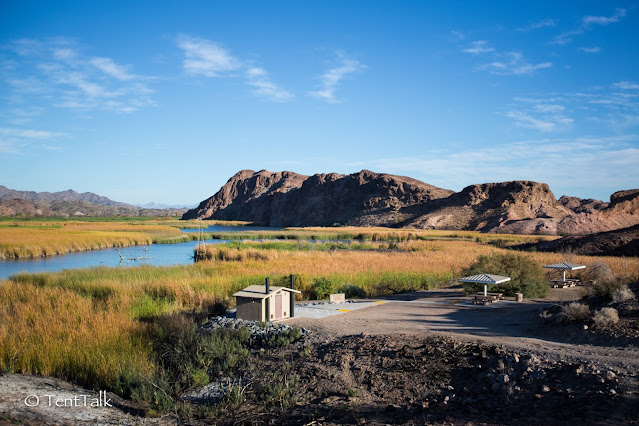
The hidden gem of this park is Taylor Lake Campground. A popular boat-in stop, Taylor Lake is the other campground you can reach by 2WD, and is only 2 miles from the entrance station. Take a quick left after entering the park, or drive through the main campground, and you will soon come to a junction, with the campground sitting on the bluffs above you to the right. The views are incredible. In the picture, you see the new toilet facilities and boat ramp that were just recently installed, as well as sites 2 & 3. This picture is taken from site #4, which has the best view of any campsite in the park that we visited.
Campsite #1 is on the hill opposite #4, and also has some nice views, but is more exposed and less impressive than #4. All regulations still apply at Taylor Lake, and these campsites go fast during peak use days. If you’re intent on getting this site; come early, set-up and pay, and then make the short drive back to explore the rest of the park. Conversely, Taylor Lake Viewpoint is just over the hill, while the road continues on towards the north and Carrizo Camp.
As you can see, Picacho SRA was a beautiful destination, and we will definitely return to camp at campsite #4 at Taylor Lake. If you’re up for the drive and the park’s remoteness, and especially if you bring a 4WD vehicle, the park is full of adventure and opportunity. For photographers, don’t forget a telephoto lens, or a pair of binoculars for those who enjoy bird-watching. We recommend going anytime between October and April, especially during the week, when the park is often nearly deserted. You can find more information on the park’s website here, and check out a few other photos below from our full day’s adventure!
Stayed at Picaho SRA already and think we missed something? Planning a trip and have a more specific question? Leave us a comment below!


Comments
Post a Comment