Posts

Showing posts with the label Mountains

Paso Picacho Campground - Lake Cuyamaca S.P.

Image
If you've been following us recently, you know our affection for Lake Cuyamaca State Park , and it was only a natural decision for us to go back and visit for a second time. As you may know, there are two campgrounds within the state park boundaries: Green Valley and Paso Picacho.  This post is about our experience at Paso Picacho Campground, the larger of the two campgrounds within the park. Green Valley, the smaller, southernmost campground, is not reviewed in this post. You can see the review of Green Valley  Here . Rancho Cuyamaca (Cuyamaca Rancho in native Spanish), a state park gem Paso Picacho is a large campsite, with 85 sites spread out over 5 loops: Manzanita (C1), Live Oak (C2), Ceder (C3), Coulter (C4), and Cypress (C5). Two group campgrounds are also available, as well as day use parking, an RV dump station, a day use picnic area, and a Cal Fire Station. The day use parking area is designed to be used for hikers accessing the four main trails that leave

Los Prietos Campground - Santa Ynez National Recreation Area

Image
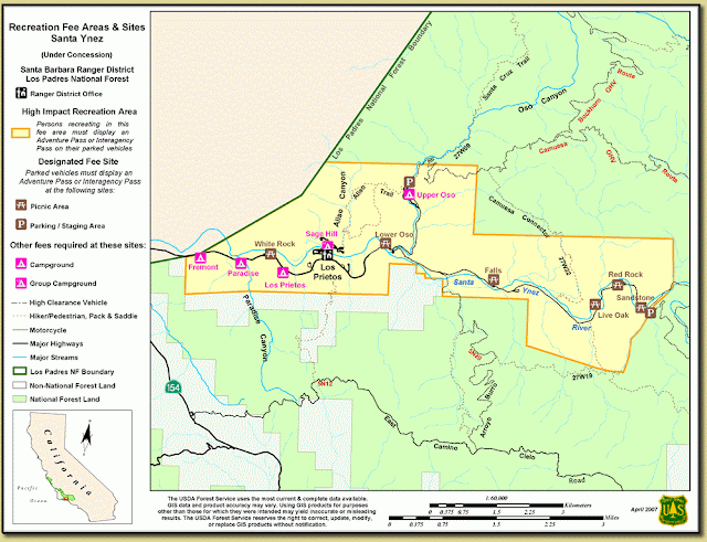
Los Prietos Campground is one of the many campgrounds that lay along the Santa Ynez river in the Santa Ynez National Recreation Area, due north of the town of Santa Barbara. Other campgrounds within the recreation area include the smaller Fremont Campground, Paradise Campground, and the upper and lower Oso and Camuesa campgrounds. At the time of our visit in mid July 2011, the Oso and Camuesa campgrounds were closed as a result of heavy rain that destroyed the bridges leading to them. Unfortunately, with the budget shortfalls affecting both the state and federal parks systems, these roads had no timetable of reopening, but are likely repaired at the time of this post. The campground is open April 1st through October 30th. There are a total of 37 campsites with fire rings, barbecue, and a picnic table at each site. Most sites can be reserved on Reserve America , but there are a select few available on a first come, first served basis. For reservations, you are required to book at leas

Stone Creek Campground - Mt. San Jacinto S.P.

Image
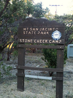
Mt. San Jacinto State Park encompasses the mountain of San Jacinto and surrounds the mountain town of Idyllwild. Better known as the mountain that towers over Palm Springs or the mountain that you take the tram to, Mt. San Jacinto has a summit of  10,834 feet and is protected by both the San Bernadino National Forrest and the Mt. San Jacinto State Park. There are over 10 campsites throughout the area, some within the state park and some within the national forrest. For this trip, we stayed at the Stone Creek Campground, one of the two developed campsites within the state park.  Stone Creek Campsite. An example of the surrounding Mt. San Jacinto Wilderness is on the right. Stone Creek campground is a relatively small 50 site campground about 6 miles away from downtown Idyllwild off of SR 243. The easiest way to reach the campground is to take Interstate 10 to Banning, where you will exit on SR 243 going South. The 243 is a very small and windy road, and it scales the northern face

Dogwood Campground - Lake Arrowhead

Image
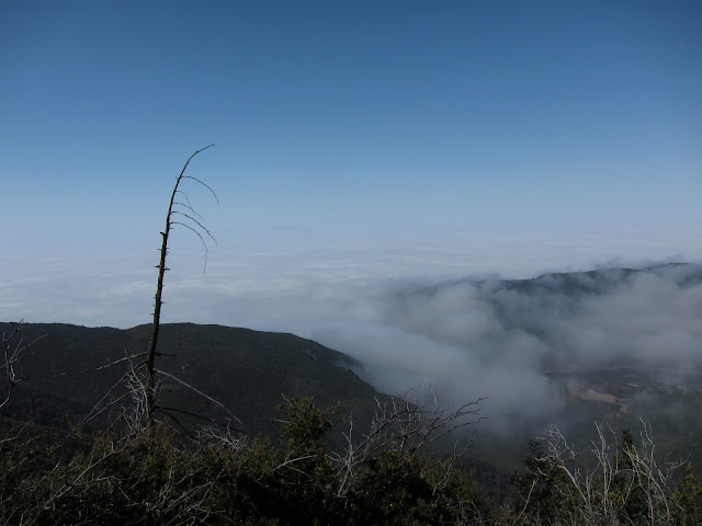
Dogwood campground is a beautiful mountain campground located about 10 minutes from downtown Lake Arrowhead and 5 minuets away from Rimforest. From CA SR 18, turn off on Daley Canyon Road, where the turn off for Dogwood is immediately on the right. It is difficult to find at night since the intersection isn't lighted, so as a rule of thumb, if you hit the high school to the east or the town of Rimforest to the west, you've gone too far. The drive up from Los Angeles is pretty painless, especially since SR 18 is a two lane highway for most of the trip up the mountain. The views from the Rim of the World Highway are spectacular, on a clear night you can see the lights of the entire Los Angeles basin. Although the area around Lake Arrowhead is pretty developed for a mountain area, keep in mind that the roads are still mountain roads, and with Friday night traffic they can be difficult for someone with little prior experience. View from the Rim of the World Highway (SR 18)